


This section of the Trans Canada Trail passes through the communities of Cassidy, Extension and city of Nanaimo. Nanaimo is the second largest city on Vancouver Island and the hub through which much of Vancouver Island’s commerce connects to the mainland. On the Island, Nanaimo is a crossroad providing access to travel and adventure north, south and west. Nanaimo was known as a coal-mining town in the mid-1800 and developed strong logging and fishing industries.
The trail between Cassidy (Haslam Creek) and the outskirts of Nanaimo (Highway 19 and Harewood Mines Rd) is considered primarily to be a hiking-oriented route, though many sections are well suited to those on sturdy hybrid or mountain bikes. Those on touring bikes should consider a bypass to this whole area as outlined on our map, such as the Parkway Trail.
The trail through the city is a pleasant combination of forested walking paths, urban commuting routes, nature parks and waterfront trails. A Trans Canada Trail pavilion is located near the Vancouver Island University in the southwest corner of the city. The trail connects directly to the Departure Bay ferry terminal, where travelers can travel to Horseshoe Bay, on the mainland in West Vancouver. Travelers having to wait overnight for a ferry might want to check out Newcastle Island Marine Provincial Park This 336 hectares reserve located right in Nanaimo Harbor is accessible by a 10 min ferry ride leaving from Maffeo-Sutton Park, just north of downtown Nanaimo (south of the ferry terminal), and offers fine camping and facilities.
Staging Areas:
GPS INFORMATION:
- KML/KMZ files can be opened in Google Earth, and many smartphone apps.
- GPX files can be opened by most GPS software apps when KMZ cannot. Note, GPX files do not contain custom colours and icons that we use on our maps; all tracks and icons will appear the same colour and styles. We recommend using KMZ instead of GPX if possible.
The files below include data for only this specific area. For all of our Trans Canada Trail data for the entire province (including features, campsites and alternate routes), download our BC.kmz master file (1.2 MB)
Visit our GPS & Navigation page for instructions of how to use your smartphone as a GPS device (even when outside of data coverage) or how to import data to your Garmin unit.
GPS DOWNLOAD (KMZ FILE)
GPS DOWNLOAD (GPX FILE)
DOWNLOAD INFORMATION SHEET
Staging Areas:
Washrooms:
Route Highlights:
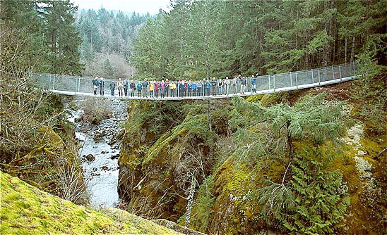
- North of Ladysmith, the spectacular Haslam Creek suspension bridge spans 18 metres above the Haslam Creek gorge and was installed in November 2002. The best time to observe the raging torrent from the bridge is in the spring. Travelers should note that the entrance to the bridge is quite narrow and may not accommodate large strollers or bike trailers. Consider alternative options if this is a concern!
- The TCT section south of the Nanaimo River is known as the Haslam and White Pine Trails.
- The TCT section north of the Nanaimo River is known as the Pipeline and Extension Ridge Trails.
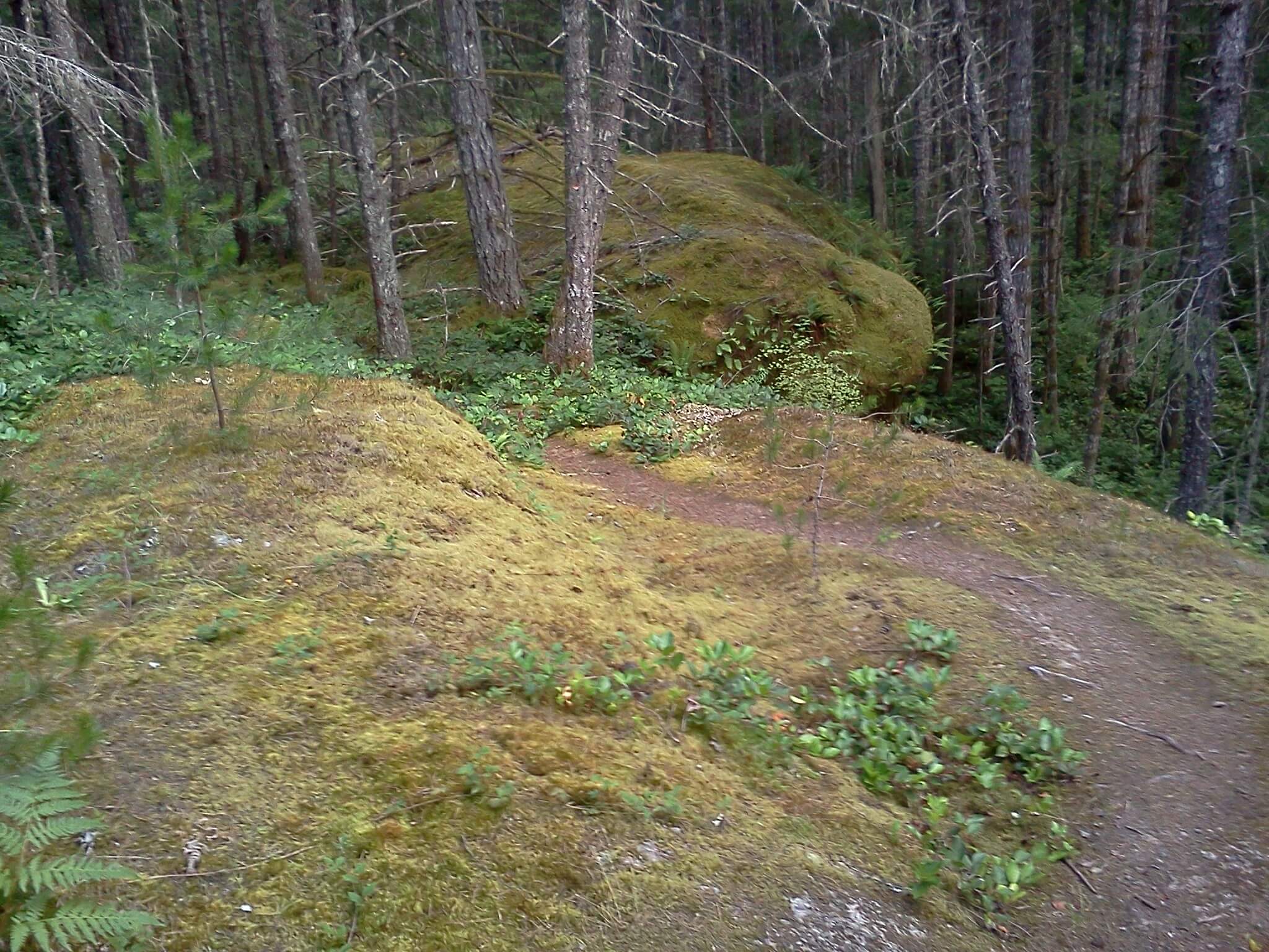
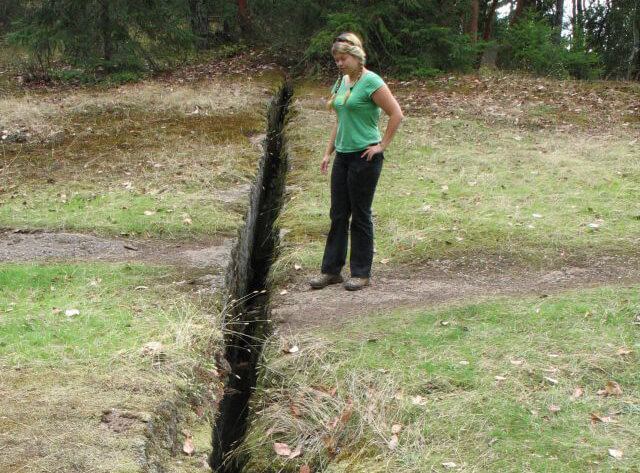
- The Abyss Trail leads you to a fascinating earthquake fissure which resulted in a gaping crack in the ground.
- There are 2 petroglyph sites in the area; one near the Abyss, the other in downtown Nanaimo
DOWNLOAD INFORMATION SHEET
Shopping:
Accomodations:
Transportation:
Directions:
DOWNLOAD INFORMATION SHEET (PDF)Northbound Directions:
The eastbound route of the Trans Canada Trail in the Nanaimo area travels in a predominantly north direction from the Cowichan Valley boundary towards the Departure Bay ferry terminal in order to cross the Salish Sea to Vancouver.
The Trans Canada Trail enters the regional district of Nanaimo just northwest of Ladysmith. A trailhead and parking lot will be constructed here in the future at the edge of the forest. At this point, the trail splits – the main route, on the left, heads north to Timberlands Road towards Haslam Creek. The trail from this point on is quite rugged and suited for hiking, equestrian and cross-country mountain bikers (no panniers). It should also be noted that a major gap in the trail exists over the Nanaimo River – if your plan is to follow the trail north to Nanaimo, you may wish to use the Haslam bypass route below, especially if you are riding a heavily loaded bicycle.
HASLAM BYPASS ROUTE: The route to the right is under development but when complete will provide a nice 6 km hiking and biking route along the Terasen pipeline corridor towards Cassidy and the airport. It can currently be travelled, but no signage exists along the route. At Timberlands Rd, turn right and cross the highway and travel north.
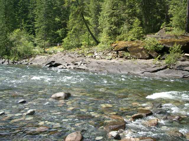
TCT TO NANAIMO RIVER: The TCT continues north, crossing the Haslam Suspension Bridge, and climbing steeply uphill on former forestry roads, following the Whitepine Trail, which is a hiking trail heading north to Spruston Road. We highly recommend bicycles take note of our map’s cycling bypass to Crystal Lake that follows forestry roads and emerges to Spruston Road at the Whitepine trailhead. A trail does continue north (called Darryl’s Way), through the lush forest north to the Nanaimo River, which may one day be the future site of a Nanaimo River Bridge – but the trail ends here for now. We do not recommend fording across the river! Instead, travel east on Spruston Road towards the highway. Unfortunately it is not possible to cross the highway at this point, so when you approach the railway overpass just before the highway, consider taking the footbridge across the Haslam Creek, then travel south to the highway crossing at the airport… then travel north on the northbound highway shoulder. Wow, confused yet? Admittedly the route is a bit convoluted.
Travel north along the highway over Haslam Creek and Nanaimo River bridges. Take the next exit, Nanaimo River Rd, and travel west 8 km to a gated former forestry road on the right (3.7 km past White Rapids Rd, about 2.5 km BEFORE South Forks Rd) which will climb uphill, take in vistas, then plunge steeply downhill. The climb on the other side is steep and challenging for those with loaded bicycles. The community of Extension lies ahead.
Loaded bicycles may wish to bypass the Abyss trail ahead, so consider riding NE on Extension Road, then turn left when you reach the E&N railway onto the Parkway Trail, which goes under Highway 19 and travels 4 km parallel to the highway all the way to Harewood Mines Rd.
For hikers and mountain bikers, pass through Extension, heading north to access the wonderful Abyss trail, which is a pleasant walk/ride to the outskirts of Nanaimo. Bicyclists will need to carry their gear over the chasm (1-2 ft gap). The trail reaches Harewood Mines Rd, travelling on it’s left side, going under Highway 19.
From the outskirts of Nanaimo, from here it’s all downhill to the Departure Bay ferry terminal, but the route can be confusing. A printed map or GPS is recommended.
- Travel on the wooded trail along Harewood Mines (1.1 km)
- Travel north on Wakesiah Ave, then turn left on 4th St to the trail behind the ballfields (1.1 km)
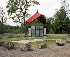
- Travel north past the TCT Pavilion, then west to Jingle Pot Rd (1.2 km)
- Travel north through Buttertubs Marsh and Buttertubs Drive (1.6 km)
- Travel east through Bowen Park along the river all the way to the waterfront trail (2.8 km)
- Turn left and travel north along the waterfront to the marina, then turn left and climb up to the Highway (1.1 km)
- Follow the highway to the ferry terminal (1.8 km)
For those spending the night in Nanaimo, we highly recommend taking a trip to Newcastle Island to enjoy its fantastic history, pleasant trails and great camping facilities. The ferries to Newcastle can be accessed nearby the Trans Canada Trail – when arriving to the waterfront trail from Bowen Park (after going under the highway), turn left instead of right. The trail continues along the water for less than 1 km to the small ferry terminal. Have a great night on this peaceful island!
We hope you enjoyed your time on Vancouver Island, and we wish you good luck on your continued journey across Vancouver and the lower mainland. Come back soon!
Southbound Directions:The westbound route of the Trans Canada Trail in the Nanaimo Area travels in a predominantly south direction from the Departure Bay ferry terminal, heading towards the Cowichan Valley Regional District boundary. If you’ve arrived late to the area, consider camping overnight on Newcastle Island, as explained below. From downtown, the route is mostly a gentle uphill and is easy to travel, but can be confusing at times, so a printed map or GPS is recommended.
Leave the ferry terminal, heading south on the highway for 1.8 km. Turn left and go downhill onto the waterfront trail. Follow the trail for 1.1 km. At this point, the trail splits. To the left, the trail continues to follow the waterfront to the Newcastle Island ferry terminal within 1 km. To the right, the TCT continues under the highway and beings its slow climb along the stream in Bowen Park for 2.8 km.
Head south on Buttertubs Drive, then follow the path through Buttertubs Marsh for 1.6 km to Jingle Pot Road. The trail crosses the road and swings east, then heads south past the TCT Pavilion and ballfields (1.2 km). Head east on 4th St, then south on Wakesiah Ave (1.1 km), leading to a wooded path to Harewood Mines Road where it goes under Highway 19 (1.1 km).
Right before Highway 19, the trail splits; walkers should proceed to the Abyss Trail, a wonderful wilderness trail and local attraction. Bicycles may proceed, but will need to shoulder their bikes over the gaping 1-2 ft chasm!
Less adventerous types may want to turn left onto the Parkway trail beside the highway for 4 km, reaching the E&N railway, then turn left onto Extension Road, headed on a long uphill to the town of Extension where the two routes converge.
For those choosing to continue on, the Abyss Trail goes for 6.7 km from this point to the community of Extension. The two routes converge and head south into former forestry lands, immediately decending steeply into a valley. Loaded bicyclists may need to push their bike up the far side. The trail surface is loose gravel and often washed out for the 4 km to Nanaimo River Road.
Unfortunately, the trail ends at the Nanaimo River Road until such time a bridge is constructed over the river; travelers must turn left and make their way to Hwy 1 (8.1 km) to cross the river using the roadway bridge – the southbound line has a contained pedestrian crossing. Continue south to Spruston Road (before Haslam Creek) – use caution as the road has a blind corner under the E&N railway.
Loaded bicyclists may not enjoy the following journey to the Whitepine Trail. Therefore, after passing under the E&N railway, cross Spruston Road (again.. use CAUTION!) and take the footbridge across Haslam Creek, traveling south through Cassidy to Timberlands Rd. Our map shows a trail following the Terasen pipeline to meet the TCT at the Cowichan Valley boundary. This is mostly a mountain bike/hiking trail and is under development, so touring cyclists may find simply following Timberlands Rd to be a fine bypass.
For the adventurers who decided to travel th Whitepine Trail, continue west on Spruston Road for 8 km to the Whitepine trailhead. On the right, you’ll see Darryl’s Way, the future TCT route over the Nanaimo River. On the left is the hiking trail which leads to Haslam Creek and the Cowichan Valley. This is a hiking route; mountain bikers however can take a former forestry road (first portion is paved.. but that ends soon enough) which curves into the bush, heading for MacKay and Crystal Lakes.
The Whitepine Trail and bypass converge at Crystal Lake, though the trail ahead is a challenging bike ride downhill to the Haslam Creek and across the Suspension Bridge. The trail emerges into a former gravel pit; continue south, crossing Timberlands Rd.
A trailhead and parking lot will be developed here in the future, as this is the boundary between the regional districts of Nanaimo and Cowichan Valley. The trail south from this point is within the Cowichan Valley and follows former forestry roads to Bush Creek and the town of Ladysmith.