


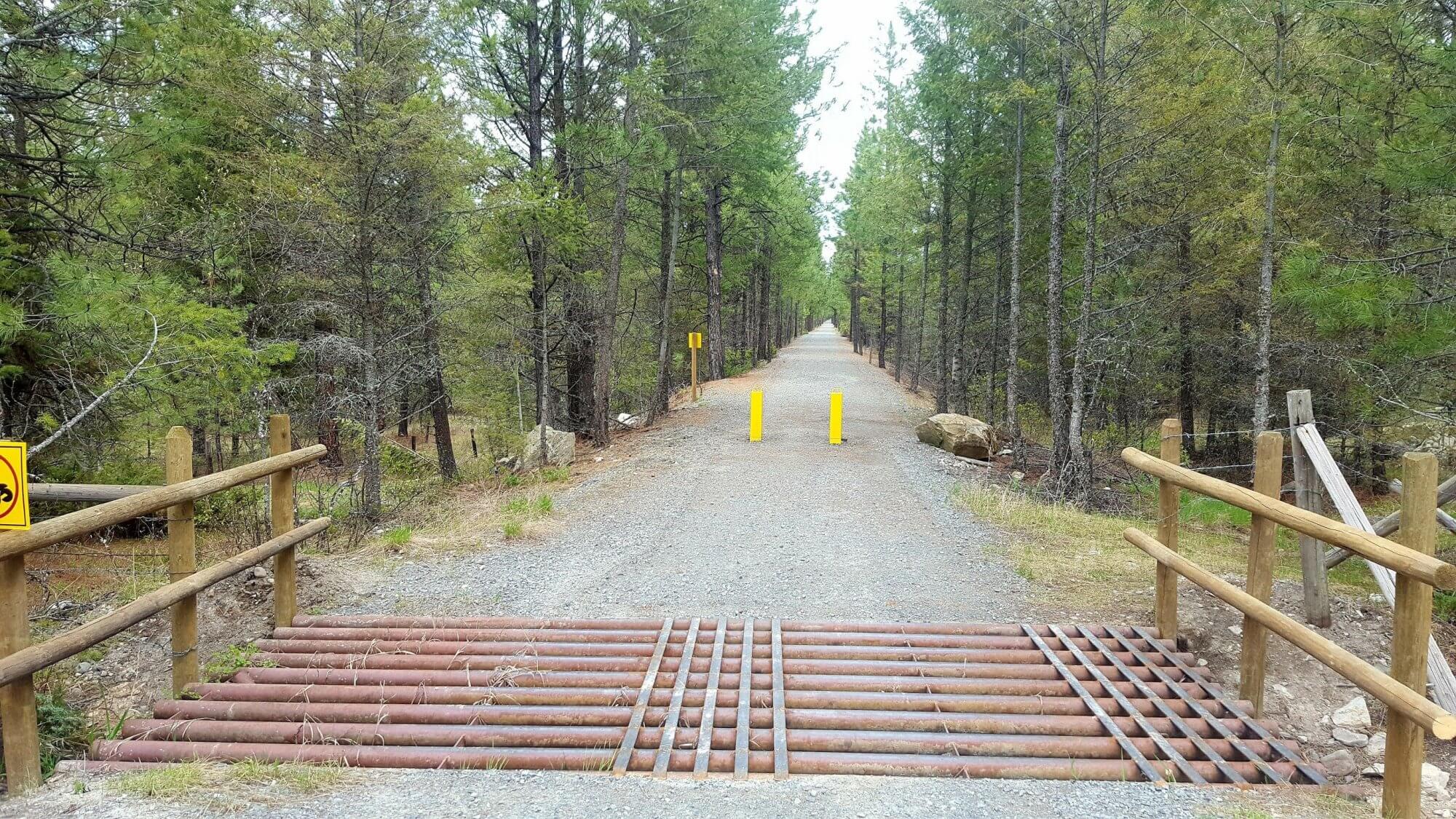
The Chief Isadore Trail from Cranbrook to Wardner has a packed gravel surface, which is half on old Rail Grade and half new trail. A 17-km “Mayook Trail” section is a new trail with enhanced single track, 1.3 metre width, with a sustained 5% grades with some short sections up to a 10% grade.
Do a loop adventure! Rampart Rest Area Loop, 6.5 km: The Rampart Loop is a family cycling or hiking loop. It begins (and ends) at the Rampart Rest Area on Highway #3. On a bike, ride the trail in a clockwise direction starting from the restroom because it is an even climb. After 2.1 km – turn right (west) onto the rail grade trail (this is an intersection with a new road). Hike or bike the rail grade west for 2.7 km. Turn right at a kiosk sign and head back to the rest area by the pond.
Mountain Bikers – try the Mayook Trail! With 17 km of trail, Mountain bikers (intermediate level) will love the fun ride along lower flanks of Mount Baker on a 1.3-metre-wide gravel trail. Elevation gain is 200 metres on well-made switchbacks and gradual grades. Begin from either the Ha-Ha Creek Road or the Pritchard Road Trailheads
Looking for a scenic 21 km loop that includes rural paved roads? Try the Ha-Ha Creek Road Loop Ride, with a stop in Wardner! Start from the trailhead at Ha-Ha Creek Road (the junction between the Mayook Trail and the Wardner Trail sections) and ride the rural paved Ha-Ha Creek Road around to Wardner, then complete the loop by riding back along the old rail grade of the Chief Isadore Trail.
The Chief Isadore Trail is a public recreation trail within active forest, range, and grassland. You may encounter livestock (May to October) and /or wildlife year round. Please do not approach livestock or wildlife. Logging may also take place near the trail. Deer and elk hunting season begins in September and throughout autumn
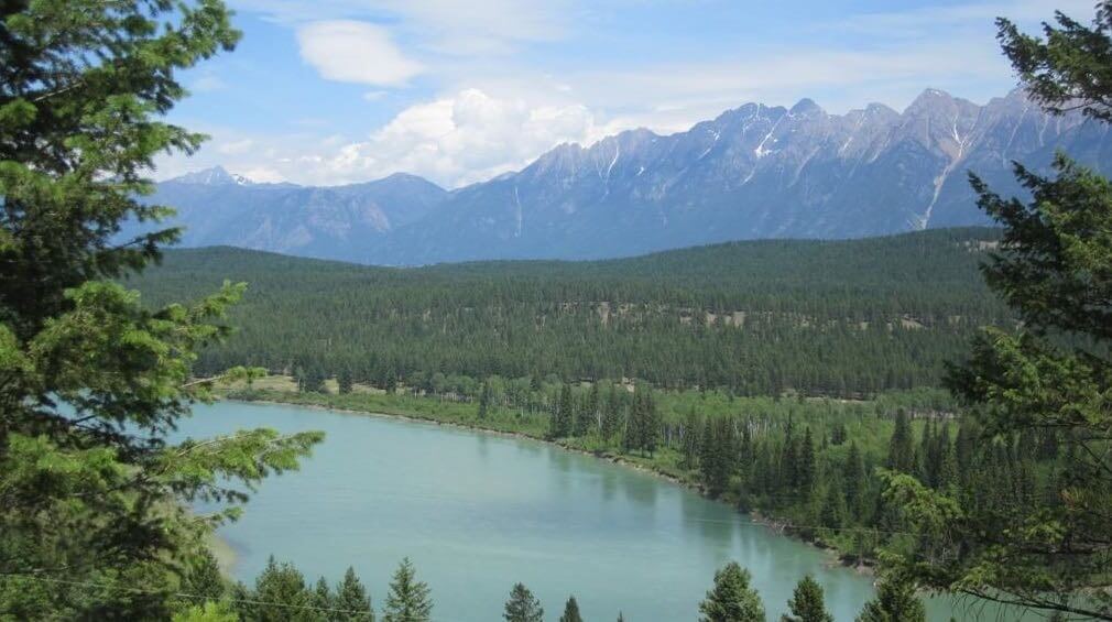
Staging Areas:
When accessing the Chief Isadore Trail from the Cranbrook side, parking is available at the trailhead, located near the junction of Highway 3 and Highway 95.
Some trail users also park further down the trail at the Rampart highway rest area. Other parking areas along the trail include Pritchard Road trailhead and Ha Ha Creek Road trailhead.
Parking is easy to find in Wardner, but some options include Wardner Provincial Park (on the waterfront) or at the Community Park (baseball diamonds, campsite, etc)
GPS INFORMATION:
- KML/KMZ files can be opened in Google Earth, and many smartphone apps.
- GPX files can be opened by most GPS software apps when KMZ cannot. Note, GPX files do not contain custom colours and icons that we use on our maps; all tracks and icons will appear the same colour and styles. We recommend using KMZ instead of GPX if possible.
The files below include data for only this specific area. For all of our Trans Canada Trail data for the entire province (including features, campsites and alternate routes), download our BC.kmz master file (1.2 MB)
Visit our GPS & Navigation page for instructions of how to use your smartphone as a GPS device (even when outside of data coverage) or how to import data to your Garmin unit.
GPS DOWNLOAD (KMZ FILE)
GPS DOWNLOAD (GPX FILE)
DOWNLOAD INFORMATION SHEET
Staging Areas:
When accessing the Chief Isadore Trail from the Cranbrook side, parking is available at the trailhead, located near the junction of Highway 3 and Highway 95.
Some trail users also park further down the trail at the Rampart highway rest area. Other parking areas along the trail include Pritchard Road trailhead and Ha Ha Creek Road trailhead.
Parking is easy to find in Wardner, but some options include Wardner Provincial Park (on the waterfront) or at the Community Park (baseball diamonds, campsite, etc)
Washrooms:
Toilets are located at:
- Rampart Rest area
- Pritchard Road trailhead
- Just NW of the Mayook section’s highest point (roughly halfway between Pritchard Road and Ha Ha Creek Road)
- Ha Ha Creek Road trailhead
Route Highlights:
- Cranbrook’s Community Forest, located just off the Isadore Canyon trail, is a great place for novice mountain biking
- Wardner Provincial Park (day-use park on the river bank within Wardner)
Chief Isadore Trail from Carla Sinclair on Vimeo.
DOWNLOAD INFORMATION SHEET
Shopping:
Provisions are best purchased in Cranbrook. Trail users travelling toward Wardner will not find much along the trail until Fernie (~2 days cycling distance)
Accomodations:
Camping is available in Cranbrook and Wardner.
Transportation:
Related Links:
- Official Chief Isadore Trail website
- Cranbrook to Wardner Destination Trail Facebook Page
Directions:
DOWNLOAD INFORMATION SHEET (PDF)Within Cranbrook itself, the TCT in essentially a loop. At the northern end of the loop, the TCT runs east-west, called the Chief Isadore Trail, connecting Cranbrook with Wardner, and beyond Elko, Fernie and Sparwood.
Directions counter-clockwise through downtown Cranbrook, the TCT Pavilion and Cranbrook Community Forest (a.k.a. The Loop)
From the northern point of the TCT loop within Cranbrook, we start at the intersection of Kokanee Road South, just east of 30 Ave N. The TCT heads south towards downtown Cranbrook as follows:
Crossing Kokanee Road South, travel south on Kokanee Crescent North for about 100 metres. Where the road bends, a small pathway will continue south. The pathway will continue south past the ball field, then turn west to run parallel with Kootenay Road South for 1 km. About 40 metres after crossing Victoria Ave, a pathway will appear on your left. This pathway heads south to 8th St. The pathway continues, but is a little to your right. It crosses 6th St and arrives at 4th St. Turn right onto 4th, then left on 17th Ave, continuing south to the end – turn right onto 1st St South. After 150 metres, the trail will diagonally cross a park, passing by the Pavilion.
Further south, at the corner of 2nd St S and 14th Ave S, turn left onto 2nd, then right onto 15th Ave S for 2 blocks to 4th St S. The trail will continue south, on the edge of the park at St Mary’s school, swinging east , passing through Kinsmen Park with the soccer field on your right and the tennis courts on your left and crossing Victoria Ave S. The trail crosses a small bridge, continuing east, merging with another trail, and arriving to 27th Ave S. Travel south along 27th Ave S. A short piece of trail swings you east again, arriving at 9 Street South. Head east along 9 Street South – the right (south) side is preferable.
After about 600 metres, you will arrive at Idlewood Park, at the corner of 34 Ave South (on the north side). We do not have detailed instructions from here, but the Trans Canada Trail crosses 9 Street South and heads north through the Cranbrook Community Forest. Travelling north along the trails, after 700 metres you will cross Baker Mountain Road, then after another 2 km, you will pass nearby Sylvan Lake. In another kilometre, you will travel alongside Four Lakes (a long skinny lake). Another kilometre north, and you will begin a large descent, as the trail swings west and travels through switchbacks down to the Chief Isadore Trail.
From here you can either turn right (east) to continue to Wardner (described below), or you can turn left (west) to head back into Cranbrook. If you choose to do the latter, you will take the Chief Isadore Trail to the trailhead at 30 Avenue North, then head south along 30 Ave N for about 600 metres to reach Kokanee Drive North.
Travelling from Cranbrook to Wardner:
This route starts from the intersection of 30 Avenue North and Kokanee Drive North. Head north along 30 Avenue North for about 500 metres – 30th Ave will bend to the left to meet the highway, but instead, continue straight and merge with Stahl Rd to the right for 70 metres. Keep left as the road (trail?) squeezes between the highway embankment and the tall fencing. In 300 metres, keeping to the left, you will arrive to a parking area and yellow gate. Beyond lies the Isadore Canyon Trail which heads towards Wardner.
The Isadore Canyon Trail runs basically parallel to the highway for 4 km before turning SE and distancing itself from the highway. About 13 km from the yellow entrance gate, the trail meets the highway yet again at Pritchard Road – and the old railway beyond this point enters private property within the community of Mayook.
Therefore, the trail now begins to climb away from the highway, climbing steadily from about 825 metres above sea level to a peak of 1000 metres over the next 7.5 km. The trail then descends back to 825 metres over a distance of 8.24 km, meeting the old railway at Ha Ha Creek Road. Cyclists preferring a much flatter trip could alternatively use the highway, but the trail is a wonderful experience.
From Ha Ha Creek Road, we’re back on rail trail for 3 km, but when the highway was constructed, some of the old railbed was made impassable at Steamboat Hill. A new trail diverts – uphill – away from the highway for 1.2 km, then we’re back on the rail trail for nearly another 6.5 km, descending gently into Wardner.
If for any reason, the rail trail is not open between Ha Ha Creek Road and Wardner, or if cyclists are looking for a novel route to return to Cranbrook, it is certainly possible to use Ha Ha Creek Road as an alternate route; the route is 11.5 km in length, and travels through quiet pastureland with decent views, passing by Bednorski Lake, and of course, Ha Ha Lake. When travelling east, Ha Ha Creek Road merges with Lang Rd and passes Lund Lake before rolling downhill onto Wardner Rd at the Kootenay River. Turn right onto Wardner Road, which becomes Laurier St within the community of Wardner.