


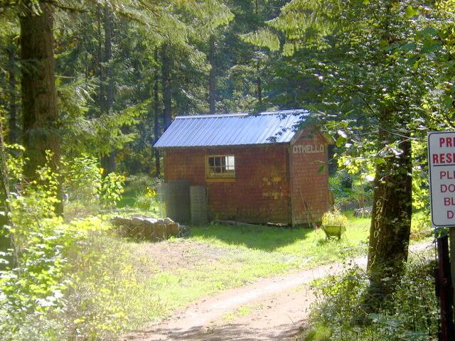
Trail Closure: Due to natural disasters along the trail early in 2022 it is not possible to continually follow the TCT trail along this route. Only sections are useable at this time. In fact, it is not, at this time, advisable to attempt using the TCT from Hope to Princeton. Some parts of the trail are also interrupted because of the Trans Mountain Pipeline construction. Please Note: The supervised gate at Carolin Mines Road does not restrict Trans Canada Trail users to access the rail grade through Jessica.
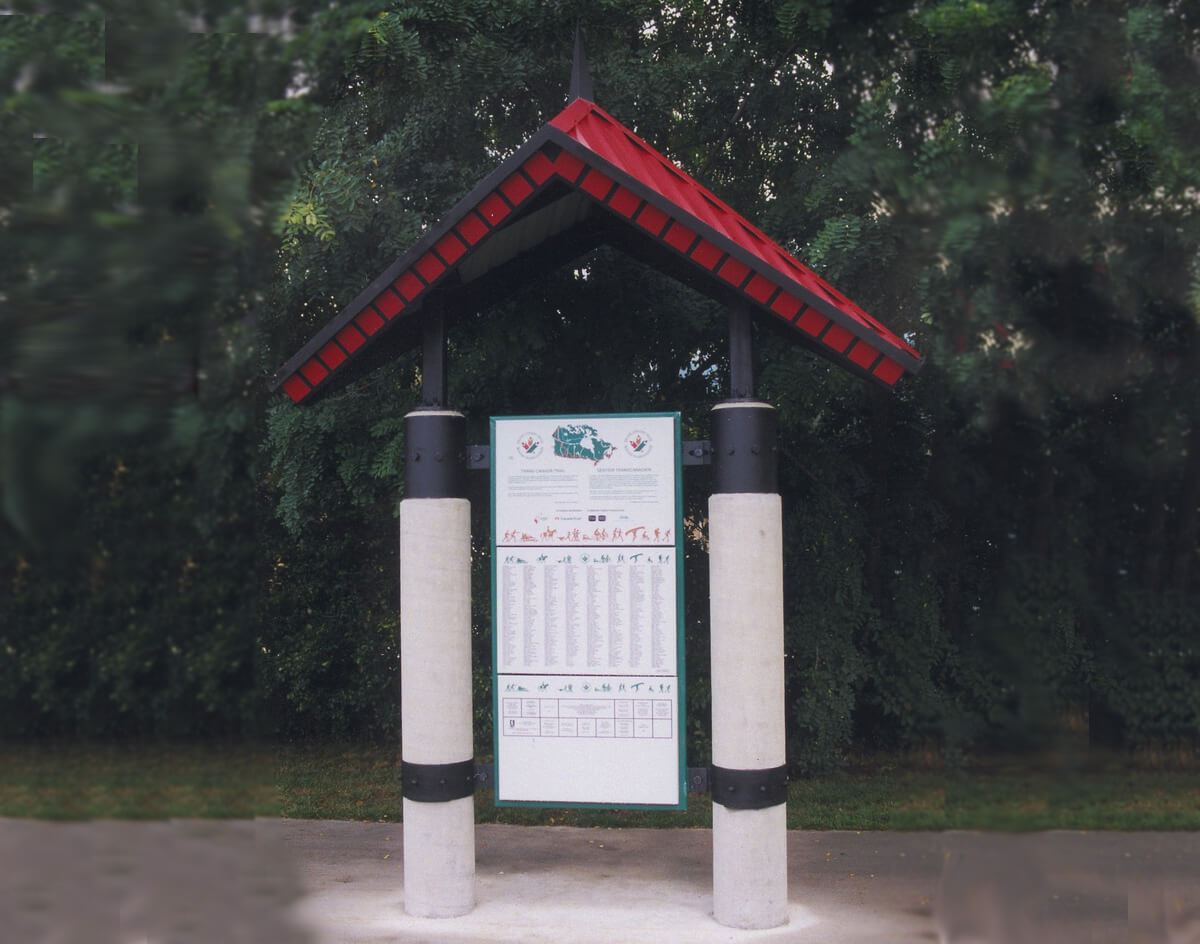
Description: From Silver Creek in Hope to Brookmere, it is quite an adventure that takes about two days to complete on a bike. Those continuing on the Trans Canada Trail should stock up in Hope for three to four days of travel involving at least three nights of camping to get them to Princeton. If you have a shuttle vehicle, it is possible to meet with the vehicle at many intervals.
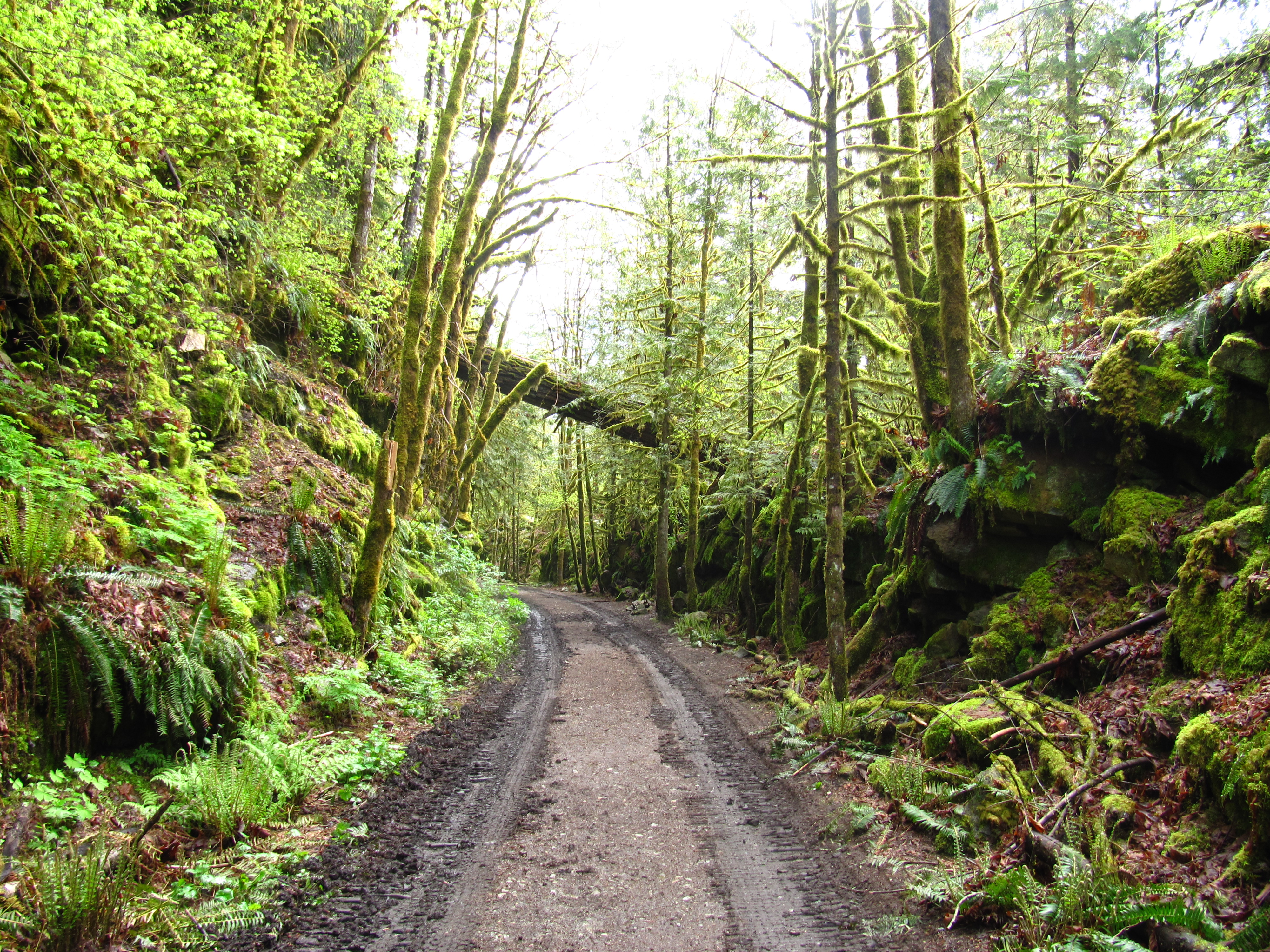
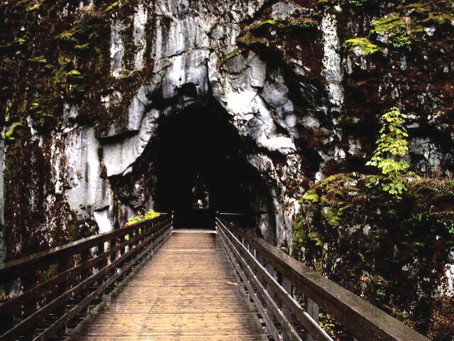
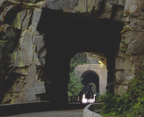
Hope is the true western terminus of the Kettle Valley Railway, which is responsible for the outstanding Othello Tunnels on the edge of town. The route from here to Brookmere does use pieces of the old railway, but much of it has been abandoned or built over by the highway.
A Special Note about the Stó:lö (‘people of the river’ in the Salish language) and the Fraser River:
The Stó:lö people can trace their heritage back between 9,000 and 11,000 years relating to their life on the Fraser River. The river, as well as a source of food and transportation, was and still is integral to their ceremonies and rituals. In the summer they lived in plank-built houses and pit houses in winter. Good places to see examples of their tradition of excellent basket-weaving and other traditional information can be found at the Telte-Yet Campground Gift Shop, the Muskwa Gallery & Indian Crafts and at the Hope Museum at the Information Centre.
From BC Parks’ description of the Coquihalla:
In the early 1900s, the Canadian Pacific Railway decided a route was necessary to link the Kootenay region with the British Columbia coast by rail. Andrew McCulloch was hired as the chief engineer in May 1910. He had been involved in many CPR projects, including the Spiral Tunnels near Revelstoke.
McCulloch took on the challenging task of building the railway over three major mountain ranges. The Coquihalla subdivision included 38 miles from the Coquihalla Summit to the junction with the CPR mainline across the Fraser River from Hope. This section boasts the most expensive mile of railway track in the world: $300,000 in 1914. The construction was done almost exclusively by hand with the assistance of a few horse-drawn scrapers and some black powder. His assistant engineers nick-named the railway “McCulloch’s Wonder”.
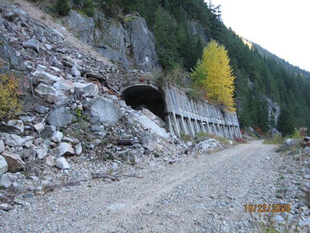
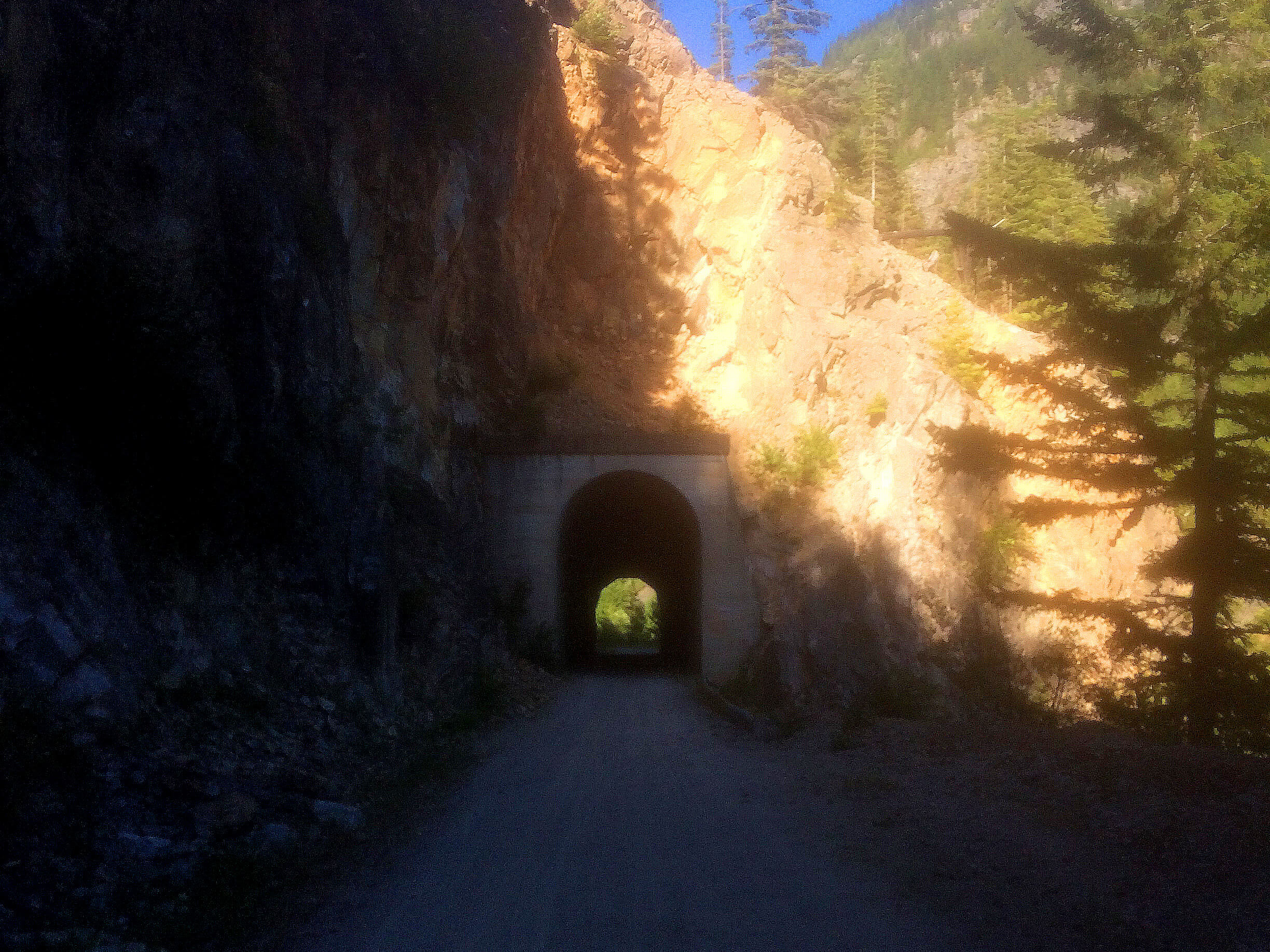
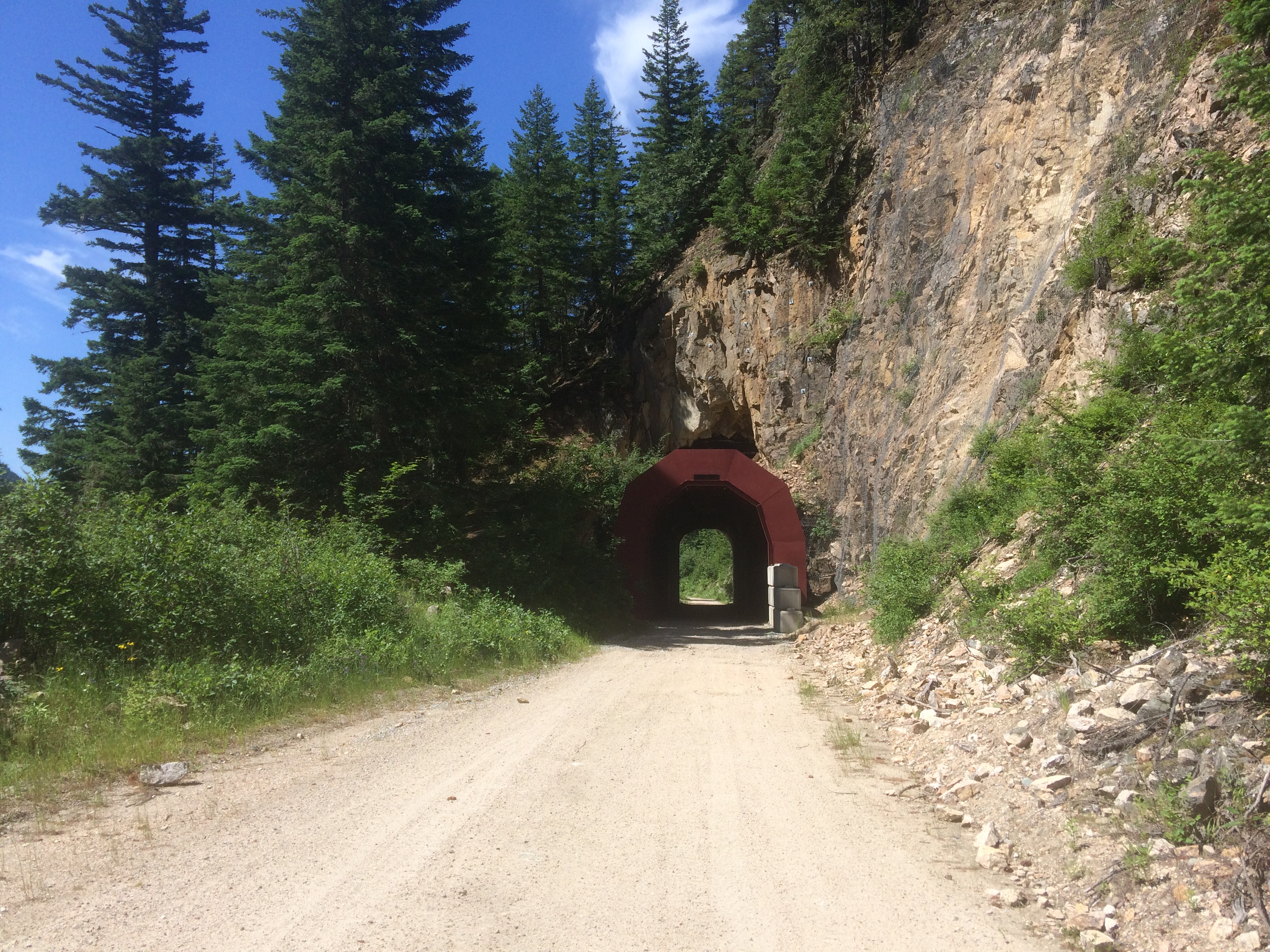
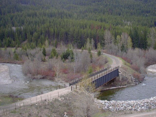
The greatest challenge of this route was the Coquihalla gorge, just east of Hope, where the river had cut a 300-foot-deep channel in solid granite. Other engineers had suggested a mile-long tunnel by-passing the gorge, but McCulloch chose to build directly through it. Hanging in the gorge in a wicker basket, McCulloch surveyed the canyon for a straight line of tunnels that could be dug simultaneously. Cliff ladders, suspension bridges and ropes allowed workers to complete what is, to this day, regarded as a spectacular engineering feat. The tunnels are known as the Othello Tunnels.
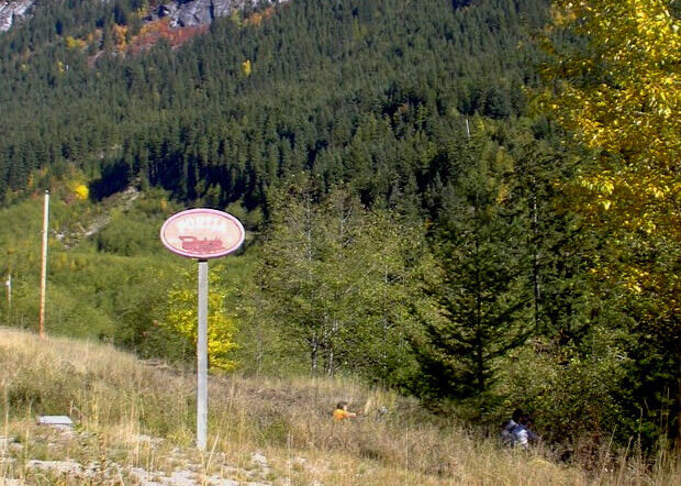
McCulloch was an avid reader of Shakespearean literature and he used characters such as Lear, Jessica, Portia, Iago, Romeo, and Juliet are the named stations of the Coquihalla subdivision. The tunnels in the Coquihalla Canyon were near the Othello station – thus, Othello Tunnels. Many of the passengers on the Coquihalla line came expressly to see and photograph the station boards and to send postcards from the stations’ post offices as a souvenir. This added an ironic touch of gentility to this adventurous journey.
The Kettle Valley Railway was officially opened on July 31, 1916. The line operated both freight and passenger service between Vancouver and Nelson, but the operation was plagued with snow and rock slides. In a two-year period in the 1930s, the line operated for only a few weeks.
On November 23, 1959, a washout was reported just north of the tunnels. The 400-foot washout was too large to be filled in one day, and numerous other washouts added to the troubles of the maintenance crews. The line was closed and never reopened. It was officially abandoned in July of 1961. The tunnels and surrounding area became a provincial park in 1998.
Much of the modern four-lane Coquihalla Highway is built upon the original rail bed of the Kettle Valley Railway. Traveling at modern highway speeds it is difficult to imagine the formidable task of constructing a rail route through this rugged section of British Columbia. As you drive along the highway (or indeed hike or bike along the Trans Canada Trail), you may notice some small signs in the shape of an old steam locomotive, with Shakespearean names. These signs commemorate the approximate locations of the KVR stations along today’s Hwy 5.
Staging Areas:
GPS INFORMATION:
- KML/KMZ files can be opened in Google Earth, and many smartphone apps.
- GPX files can be opened by most GPS software apps when KMZ cannot. Note, GPX files do not contain custom colours and icons that we use on our maps; all tracks and icons will appear the same colour and styles. We recommend using KMZ instead of GPX if possible.
The files below include data for only this specific area. For all of our Trans Canada Trail data for the entire province (including features, campsites and alternate routes), download our BC.kmz master file (1.2 MB) Visit our GPS & Navigation page for instructions of how to use your smartphone as a GPS device (even when outside of data coverage) or how to import data to your Garmin unit.
GPS DOWNLOAD (KMZ FILE)
GPS DOWNLOAD (GPX FILE)
DOWNLOAD INFORMATION SHEET
Staging Areas:
Washrooms:
Public Washrooms can be found at the Hope Information Centre, next to the City Hall, the Recreation Centre, and at the parking lot at the end of Tunnel Road.
Route Highlights:
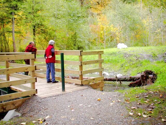
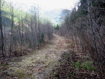
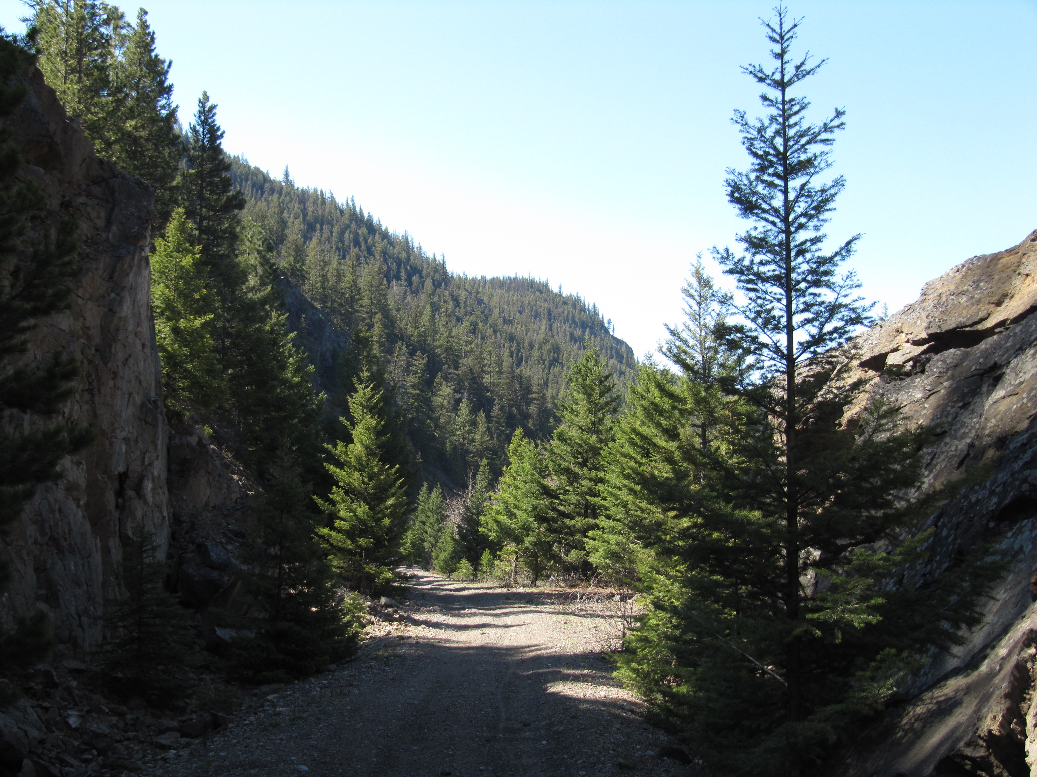
Starting in Hope at the Trans Canada Trail and Tourist Information Center, the first thing to notice are the large wood carvings by the local artist Peter Ryan along the streets representing wildlife, pioneers, and local industry. Do visit the Memorial Park behind the City Hall where there is a Japanese Garden built in 1991 to honour the Japanese-Canadians who had to remain in internment camps during the 2nd World War. Also at the Recreation Centre it is worth a stop to see the large mural over the pool. Out of town after crossing the Coquihalla River is the start of the KVR rail trail at Sucker Creek. It is worth noting that the actual start of the KVR is along Hwy 7 just before arriving in Hope. The first section of trail is on and off the rail grade to accommodate fish channels. The rail grade soon reaches the Coquihalla Canyon Provincial Park, a marvel of engineering following a spectacular gorge of rushing water under rail bridges and entering the carved out Othello Tunnels up to Othello Station near the parking lot. From here to Juliet the trail is on and off the rail grade. From Juliet it is basically the rail grade all the way to Brookmere. From Lear to the Coquihalla Lakes one should not expect a typical level rail trail as the trail goes on and of the grade itself due to the Highway being on the grade at times, blown out bridges, and caved in tunnels. The Trans Mountain Pipeline uses parts of the grade for its utility road and is part of the Trail when that happens. Hence, expect a great variety of trail experiences including some fairly steep inclines. The highlights will be the 5-km section through Jessica and the 24-km Coquihalla Summit, always following the Coquihalla River. The Summit offers waterfall sprays, great views, a tunnel, former rail snowsheds, interesting remnants of railway structures, etc. There are also remnants of a Cattle Drive Trail. Worth observing are also the marvels of engineering of having constructed a pipeline in such rugged and unforgiving geology. Try not to miss the Bridleveil Falls of Falls Creek about two-thirds through the summit pass. From the Coquihalla Lakes it is again a different experience now following the Meandering Coldwater River up to the Brodie Y. It is much flatter but the trail is often in a tight squeeze between the river and the Highway. Between Juliet and Brodie expect to cross two challenging slides, all part of the adventure. In Brookmere one is greeted by a picturesque railroad water tank and other railroad buildings. Of interest is the naming of the KVR railroad stops after Shakespearean characters by Andrew McCullough, the KVR’s chief engineer. The TCT often uses these as ways of identifying locations along the KVR. Other Interesting Trails in Hope (get more information at the information Centre):
- Walk along the Fraser River from the Information Centre in Centennial Park
- Rotary Nature Trail (1 km) – The trailhead is off Wardle Street where the Coquihalla River joins the Fraser River.
- Mount Hope Trail (10-km round trip depending on how far one gets by vehicle)
- Hope Lookout & Loop (2 km) – near the intersection of Flood Hope Road and Highway #1
DOWNLOAD INFORMATION SHEET
Shopping:
There are a good variety of shops and restaurants in the Hope town centre.
Accomodations:
There is excellent camping at the Coquihalla Campground at the west side of the bridge before crossing the Coquihalla River on Kawkawa Lake Road. Hotels and Motels are plentiful in the town centre. Telephone the Hope Information Centre: 604-869-7765.
Transportation:
Related Links:
Tourism BC – Official Site Coquihalla Canyon Provincial Park Coquihalla Lakes Lodge – A Snowmobile Heaven
Directions:
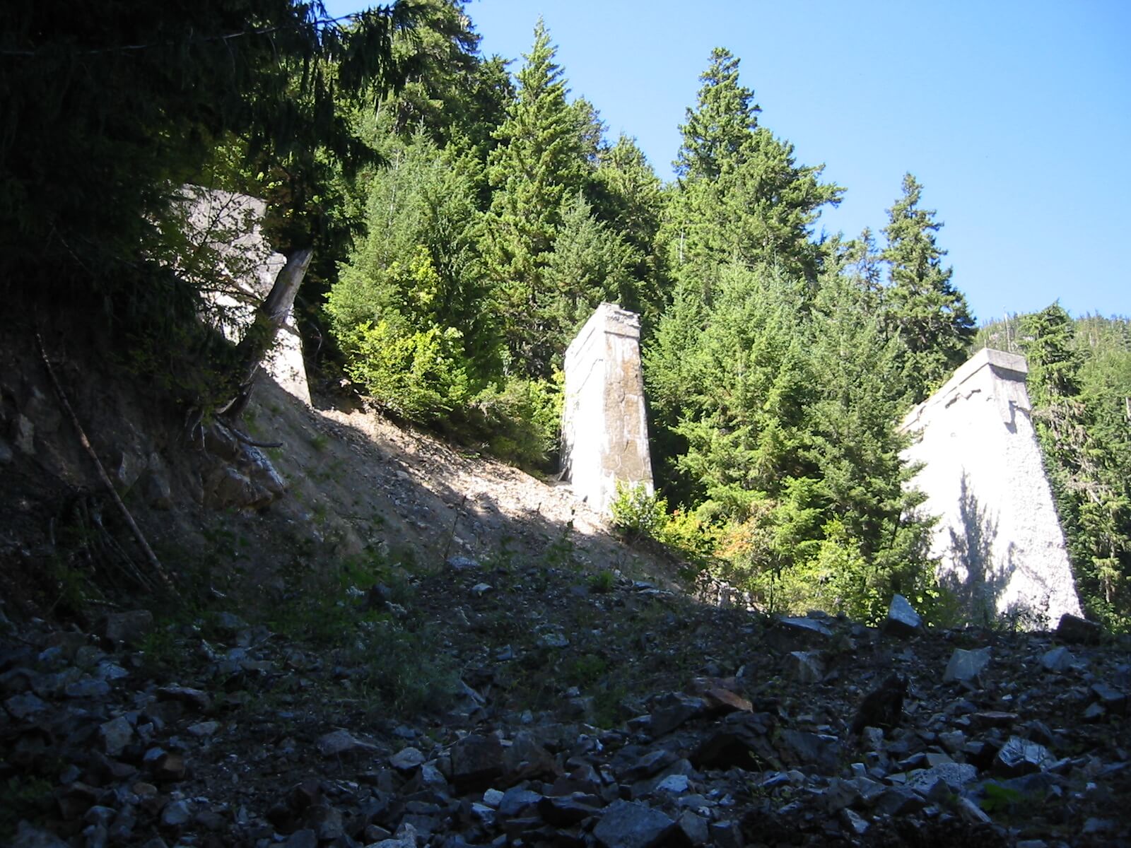
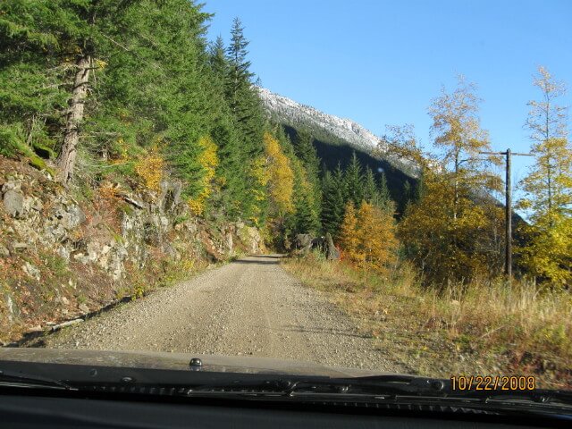
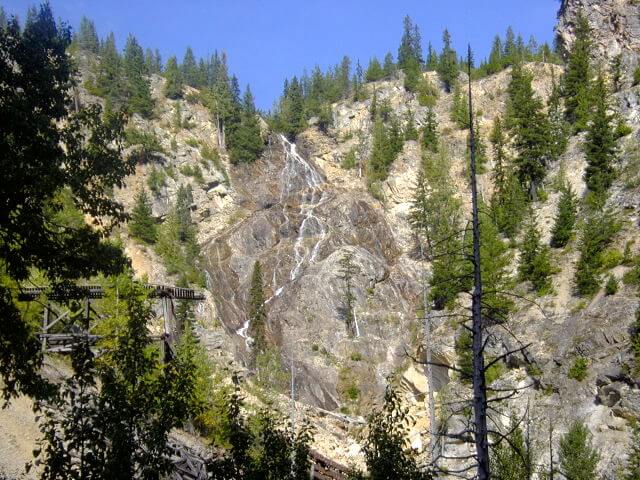
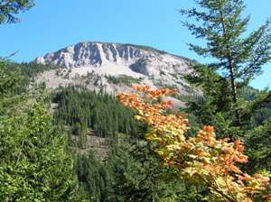
DOWNLOAD INFORMATION SHEET (PDF)Silver Creek Trail – 4 km Starting at the Hope Boundary follow the Silver Skagit Road to Flood Hope Road (2 km). Turn eastward on the Flood Hope Road passing the Silver Creek Community, to the Hope Information Centre, the location of a Trans Canada Trail Pavilion. Hope Centre – 2.75 From the Information Centre proceed east on Hudson’s Bay Street and turn north on Fraser Avenue to Wallace Street. Continue on Wallace Street eastward to 6th Avenue. Along Wallace Street appreciate the series of large wood sculptures and perhaps visit the Memorial Japanese Gardens dedicated to their Internment during the Second World War. Follow 6th Avenue southward to the Recreation Centre. Just before continuing, take a look at an extraordinary wall mural inside swimming pool area. Proceed between the buildings eastward to a forested park behind the Centre. From here take a trail leading to the bridge on Kawkawa Lake Road. Cross the bridge and turn immediately north on Union Bar Road to the Sucker Creek Fish Enhancement area in the Thatcher Fraser Valley Regional Park and the start of of the TCT on the KVR. Coquihalla Canyon Trail – 3.7 km Check out the Google Map for an alternate route to by-pass the tunnels for equestrians and also for hikers wanting a loop trail, and for all users during the winter months when the Coquihalla Canyon Provincial Park is closed. At the Sucker Creek Fish Enhancement area pick up the Othello Trail just east of the creek. This trail basically follows the former Kettle Valley Railroad to Kawkawa Lake Road. Cross over the road and follow the Kettle Valley Road to the Coquihalla Canyon Provincial Park. Continue past the parking lot onto Tunnel Road which becomes Othello Road. Please note: cyclists must dismount for approximately 0.4 km from the start of the tunnels to the last tunnel, including the bridges. You are invited to take in the spectacular scenery without endangering your safety and the safety of others. Othello Trail (Othello Station to Sowaqua) – 14.2 km From Othello Station, continue on the Othello Road. Stay on this road to Highway 5, go under the Highway, then continue east on the utility road that parallels the east side of Highway 5 up to a Bailey Bridge. While waiting for a bridge to be built over the Coquihalla River 4 km from here, cyclists can hop onto the shoulder of the Highway going north from the former cable car tower. After using the highway for about 4.6 km from the former tram or cable car tower there is a service road on the right side of the road barriers. Hop on to this roadway and continue north for 2.2 km. Be sure to take the trail heading into forest and stay on this trail in out of the forest following TCT signs, at times right next to the Highway, to where the Coquihalla River goes under the highway to the west side. Jessica Trail (Sowaqua to Portia) – 11.9 km The trail section from where the trail goes under the Highway at Sowaqua Creek to Carolin Mines Highway Interchange is 5.3 km. Once on the west side of the highway proceed up to the railroad grade after crossing the utility road then picking up on a narrow trail through trees climbing 0.35 km to the rail grade. As long as one stays on the rail grade, the private property signs at Jessica Station about the half way point can be ignored. At Carolin Mines road go down towards the highway. Proceed under the highway at the Corolin Mines exit and follow the service road that parallels the highway with the Coquihalla River heading north. Follow this road over Ladner Creek all the way up to the approach to Shylock Road Exit 200. Take a 2-km off-highway trail just before the exit and follow it to Portia above Boston Bar Creek. Coquihalla Summit Trail (Portia Station to Coquihalla Lakes Station) – 24.4 km We usually anticipate that the Summit will be almost clear of snow by June 1 (2012 season – this was in late June) (Changes from this will be posted on this site). It may be necessary to walk bikes over patches of snow in shady places. Watch for the numerous rocks and boulders that may have fallen on the utility road. Where creeks have washed the surface of the roadbed in several places there is coarse surfacing put in by Trans Mountain Pipe Line. Cyclists must keep their attention on the roadway to avoid loose rock and soft gravel. Dismount to look at features and scenery. When the snow clears, cyclists, walkers, and equestrians can get through but must safety conscious. You must dismount and get well off the road when meeting Trans Mountain Pipe Line construction equipment. Our license to operate in the Trans Mountain/Kinder Morgan Pipe Line corridor in the summit restricts us to walking and cycling only. Equestrians are also allowed but will need to alter the routing somewhat to get around gates. If there is dangerous work going on in the summit it will be temporarily closed and signs to that effect will be put up requiring cyclists to use the shoulder of the Highway as an alternative and walkers will need to organize a shuttle to get past the summit. Please note that there are gates to keep out all public motorized traffic (including ATV’s and dirt bikes) at each end of the Summit Trail. Most times bicycles need to be lifted over 2 such gates. Beware of fallen rocks on the roadway. The 3.3 km section of the KVR 1.4 km above Portia leaving the Trans Mountain Pipe Line’s road is now completely restored and for the exception of detouring around former bridges is the historical KVR rail grade. The first 800 m is used by Trans Mountain Pipe Line to reach a gravel pit. The next 2.5 km is now a completed trail offering spectacular views, tree cover, and even a pleasant veil-like waterfall. Vestiges of the train years such as telephone poles, railroad ties, bridge abutments, extraordinary rock retaining walls, etc. can also be seen. The next 5 km to the rail tunnel is a continuation of the rail grade above a high cliff first passing Iago (3 km). 1.2 km after the concrete snow shed and a tunnel 0.4 km to a bridge site, is the mysterious “Hole in the Wall” and, very soon after, the rail grade ends but can be viewed on the cliff sides as you travel on the Trans Mountain Pipe Line Utility road. ***A new opportunity*** (Marked in red on the Shylock to Coquihalla Lakes Map above) At the end of August 2006 our volunteers restored 2.7 km of the rail grade for walkers starting about 20 metres past “Hole in the Wall”. Watch for a very narrow trail going uphill on your left (Adventurous cyclists willing to push their bikes up this narrow trail, a few other tough sections, and another narrow trail with switchbacks to get back down at the other end can try this section of rail grade as well.) This trail offers great vistas, collapsed snow-sheds, and an opportunity to view the high concrete pillars from the top and bottom of the longest train bridge of its kind on the KVR. Before descending there a a short trail to the top of the west pillar of the former KVR bridge (photo opportunity). Once you descend the trail at the east end the pillars and abutments of the former KVR bridge are an extraordinary photo opportunity. Cyclists may want to just go to this site by continuing on Trans Mountain Pipe Line Utility Road and take a very short side trip on an old rock haul road just before crossing the bridge at Needle/Slide Creek. By leaving the bikes below a hike up the new invigorating trail to the rail grade and to the top of of the west abutment of the bridge is a memorable highlight in this corridor. This summit route uses the KVR for half of the distance and the rest of the time vestiges of it can be spotted mostly high on the mountainside away from the pipeline service Road. At Needle Creek (also known as Slide Creek), approximately halfway into the summit, do take the time to go up a short distance along the creek on a quarry road to look at the huge KVR bridge abutments (Monumental Rail Pillars). The longest free bridge span on the KVR was at this location (see description above to access the rail grade here). This is also the beginning of BC Park’s Coquihalla Summit Park which extends to include the Coquihalla Lakes. Hopefully, this will, one day, be the site of a BC Parks campground for cyclists and hikers. North from this point the Coquihalla River goes underground during the summer and therefore, water becomes scarce from here northward. Also, 6.7 km later the spectacular Bridalveil Falls of Falls Creek, the site of a vestige rail bridge in the foreground, is yet another great feature along this route. At the north end, vestiges of rock walls on the east side of the river recall cattle drive years. Then it is onward to the Coquihalla Lakes, a real mountain oasis. As an alternative to this Summit Trail, cyclists may use the shoulder of the Highway from Portia to the Coquihalla Lakes. Just past a set of washrooms at the former toll booth site, take the road down to meet the main trail. This may be necessary because of snow in the shaded valley of the Summit Trail early in the season. Juliet Trail (Coquihalla Lakes Station to Juliet Station at ‘person gate’) – 17.7 km The route combines the KVR (8 km) along the Coldwater River and the Trans Mountain Pipe Line Right of Way (5.2 km where the KVR is overtaken by the Highway). Less adventuresome cyclists, can overcome the difficulties by staying on the shoulder of the Highway. From the Coquihalla Lakes Station go for 2 km to the Briton Creek Rest Area to find wahsrooms and great interpretive panels of the trail and area. Continue north 0.8 km to go over the Highway at the Coquihalla Lakes Exit 228. Then cross over the former KVR bridge and go back under the highway by following the bank of the Coldwater River to rejoin the former KVR. Follow the rail bed to the Mine Creek Forest Service Road Exit 231. The trail continues between the Highway and the Coldwater River and rejoins the KVR as it approaches Juliet Station. Juliet Station is located on the other side of the Highway after crossing the rail bridge over Juliet Creek and going under the Highway (This highway interchange can be a bit confusing. Keep in mind that you need to get to the other side of the Highway). Brodie Trail (Juliet Station to Brodie Station – 9.4 km) From the Juliet ‘person’ gate 2.4 km past the overpass after taking the road that parallels the highway there is a self-closing gate installed for trail users at the animal fence. From the gate follow the KVR all the way to Brodie Station on the east side of the Highway. The two major washouts, about 750 m apart, along this route are particularly difficult for cyclists and unsuitable for equestrians. Both these trails (150 m long) require the pushing and lifting of bikes. A walking trail gets rebuilt yearly by the Nicola Explorers across these slides. They are very sandy and are subject to continuous filling in from above. Dismount and take great care crossing these slides watching for anything coming down from above. The trail going over one of the slides is no longer usable. Cyclists always have the option of staying on the shoulder of the highway, in which case, will need to go up the hill to the Larson Exit 250 and turn back south on the east side of the highway to the Brodie rail bridge. Brookmere Trail (Brodie Station to Brookmeere Station – 6.3 km) Cross over the rail bridge going east (the other branch heads for Merritt, hence the name Brodie-Y. Follow the rail grade all the way to Brookmere. You may have to negotiate one or two small slides along the way.